Guests Aboard: A Week with Parents

Welcome guests for a few days cruising.
We slipped our lines on Tuesday and motored out of the harbour on our way to Sidney. I needed an oil change and wanted to get someone to look at my stuffing box, so I had booked Vector Yacht Services in Tsehum for 8 a.m. Wednesday morning. Also my parents were flying into Sidney for a week on Wednesday evening, so it looked like it would all work out. We timed our departure to hit Enterprise around slack and planned to ride the flood all the way to Sidney. Luckily the bizarre currents off Victoria were in our favour and we got an almost 2 knot push all the way to Trial Island as well. If we were staying in the area I would definitely be buying a Current Atlas so these things wouldn’t be such a surprise. But, as a result, we cut almost an hour off our estimated time. The wind, as usual, was on the nose the whole way.
We had a nice stern-in berth waiting for us at Sidney and since they are still on winter rates the price was right. As soon as we were tied up and settled, we grabbed the grocery cart and backpacks and headed off to the convenient Fairway Market to provision. This was really our first taste of having guests aboard because after having the boat to ourselves for almost 10 months we had to consider other people’s tastes and of course work out portion sizes. My parents — both circling around the 70 mark (although mom was a bit of a cradle robber) — were going to be here for around a week and —weather dependent — we might be away from dock the whole time. So we had to consider both amount and tastes when getting perishables like milk, bread and greens and had to double up on meat portions and other produce. The corollary to this of course, is that our finely-tuned storage methodology was thrown out the door and we had to start stuffing things in a bit willy nilly. It’s amazing how much an extra litre of milk or loaf of bread can change how you usually stow things in the fridge or freezer, to say nothing of where you put all that extra beer.

Sunrise on Haro Strait
The next morning we were up early and had cast off by 7:30 to make the 2 or 3 nm trip over to Tsehum. The entrance to Vector’s docks is buried in amongst the public wharfs and boat houses and we gave up searching eventually and phoned in for directions. Then we had to back into a tiny slip around a 100° corner, but there were plenty of hands on the dock to make sure I didn’t screw up. For the next hour or so I watched the pro’s change my oil and oil filters and install the two new fuel filters I already had. It came to a grand total of $200 and change including tax; a bit more than I wanted to pay but it was good to watch someone change the racor (fuel filter) as there was a bit of a trick to handling the gravity feed. And it saved me buying the tools. Then we cast off and were tied up back in Sidney a little after 10 a.m.

Crowded, but great service at Vector Yacht Services
I had been delaying laundry since I knew Sidney had great facilities with lots of machines so that was the next chore. We did all the blankets, sheets and towels as well as our regular accumulation of clothes. Sidney is also only $2.50/load which saves us $.50/load over our Wharf Street facilities. However the machines wouldn’t take twoonies so that rendered my loonie/twoonie stash useless and we had to buy a bunch more loonies and quarters to get all five loads done. The marina office is great and was able to provide all our cash changing needs.
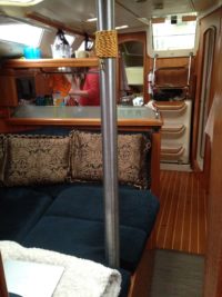
The next chore was to rearrange the boat to accommodate two more people. We decided we would move into the “garage” (v-berth) and give up the aft cabin for our guests. In addition, we would have to raise the salon table to eat on thus giving up our “lounge” with it’s blankets and pillows. What this means is that even without worrying about the additional bodies and their gear, we had a lot of rearranging to do to find stowage for cushions, pillows, charts and sundry gear that normally was just stored in the v-berth. Then we had to clear out shelf and locker space so they would have a place to unpack and find room for our stuff in the smaller forward cabin. But a couple of hours of rearranging resulted in something that was serviceable and sailable, albeit a bit cluttered looking.
Then we wandered beautiful Sidney by the Sea, enjoy the warm day before grabbing a bus to meet my parents at the airport. After all the arrival greetings and rituals, we grabbed a cab back to the marina and started to settle them in. First up was my orientation and safety lecture. I had been working on a check list for guests, so this was my first opportunity to try it out. All in all I think it went pretty well — at least everyone stayed safe and the visit was relatively drama-free. Dinner was bbq’d burgers, beer and great company. The weather has turned so we are back to eating in the cockpit. Later I baked raison bread for breakfast and then we chatted for the rest of the evening. I grabbed a late-evening shower before we all hit the sack.

And we’re off
The weather look like it would hold to Sunday so we cast off the next morning for Butchart Gardens after topping up the water tanks. The wind was negligible so we motored most of the way around the top of Saanich Peninsula. Along the way my dad screwed with my Garmin fish finder — which I had never used —and we spotted a few fish, which gave us some hope for later. Soon enough we pulled into the small inlet across from Butchart and started for their free mooring balls. I noticed that most of the dock was roped off with plastic yellow tape but didn’t give it much thought. So we grabbed a mooring ball and my dad and I rowed ashore to set the stern line; having a coxswain sure makes that exercise easier. But about 2 minutes after we had got back from securing the stern tie, someone hailed us from the dock and told us the back entrance was closed and we would have to either go over to Brentwood Bay and take the bus or around to Tod Inlet and hike in. Disappointed that the famous “back door” was closed, we lowered the motor onto Laughing Baby and then gently loaded our passengers before taking off. With a full load of 4 passengers the trip was neither quick nor dry, but we made it down to the park docks with little drama.

The docks in Tod Inlet — a 10 minute walk from Butchart’s front gates
Butchart was stunning as always and the tulip beds were pretty phenomenal considering the ones in Victoria were almost gone. When we were entering, I checked in at the info booth and it turns out there was some question about whether or not they would let us stay at their mooring buoys, but eventually after passing the buck a few times, someone ok’d us to spend the night. We wandered the gardens for a few hours before heading back to the boat.


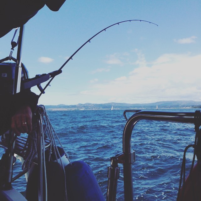
Back on board, dad set up the fishing gear he had brought along and mooched (?) off the bow while the rest of us relaxed. I made some more bread for dinner and did a small pork roast in the oven. It was a quiet and calm evening except for the Canada geese and we relaxed and visited in the fading sun before calling it a day.

No fish, but then, that’s not the point, is it?
Moving on
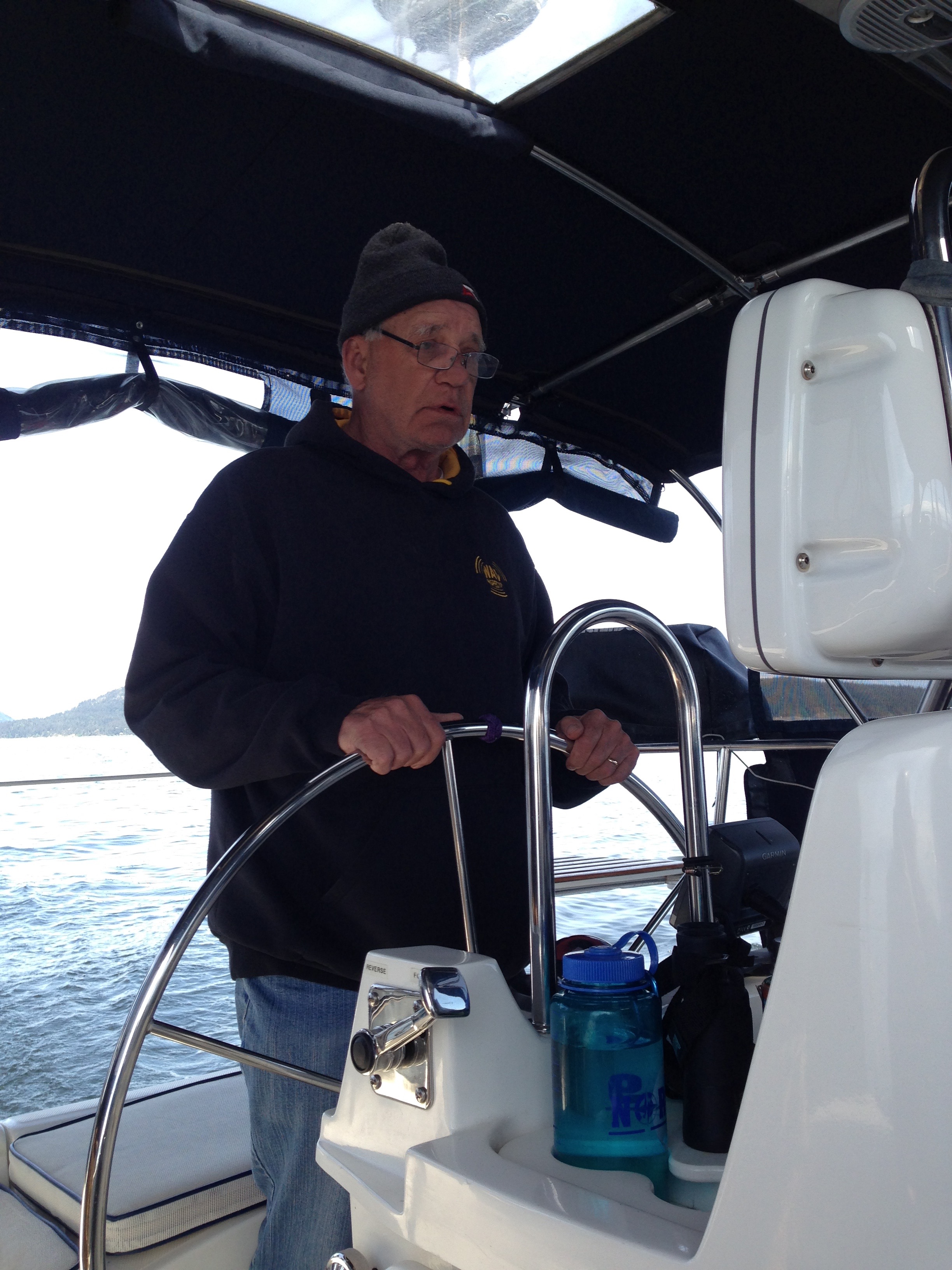
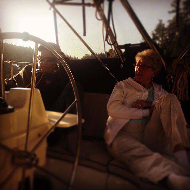
The next morning was coffee on deck (perk’d for the special guests) and general relaxing. Eventually everyone was up and around, so it was time to cast off. We decided to make use of all the extra crew, so I put my mom at the wheel while I cast off the stern line and my dad and Leslie took on slipping the bow line. Mom manoeuvred us around the mooring balls and took us out of the bay, and we headed up the inlet for Portland Island.

Taking us out of the cove.
The winds were about 6 to 7 knots on the nose but we decided to sail anyway since we had all day. And since we were only making about 3 knots, my dad broke out the fishing gear, while my mom tacked us back and forth for an hour or so. Eventually we decided we weren’t making enough way ( I think we were going mostly sideways) so we furled the jib and started motor-sailing towards Patricia Bay — but we kept the revs down and continued to troll as we slowly made our way north towards Satellite Channel.

Competent crew at the helm while under sail.

Trolling in Saanich Inlet.
Despite the presence of three or four other boats trolling we didn’t even get a nibble and, as we we turned east at the top of the peninsula, the winds started to climb. So we hauled in the fishing gear, killed the engine and started to sail towards the north side of Portland Island, our destination. The winds quickly climbed to 12–15 knots and we were racing along close hauled for a while, but after about 3 or 4 tacks the slightly alarmed look on my mom’s face convinced me that heeling just wasn’t her thing. So we turned into the wind, furled the sails and motored the last 15 minutes to Royal Cove.
 Stern tying again, we dropped anchor this time and Leslie was thrilled with our newly renewed chain markings. Once again the extra crew made the whole process easier and more stress-free; turns out an extra set of hands is a good thing. The winds were out of the north and it would turn out to be our bumpiest stay in Royal Cove ever. But it was never that bad and it gave my parents an opportunity to experience a little boat rocking. We settled in and decided on a small hike. So we loaded up the dinghy and rowed over to the dock to hike out to Arbutus Point. Turns out that loading 4 people in a dingy off the transom is not the easiest operation and it took some shuffling to keep everything balanced.
 After a 10 minute hike, we spent an hour or two exploring the midden beaches and shoals in a flood tide, spotted some ducks, otters, and anemones and generally soaked in the atmosphere. The point was also populated by tons of kayakers enjoying the spring weather. On the way out and back we saw plenty of new wildflowers but unfortunately none of my pictures turned out.

That evening we enjoy another lovely sunset while I cooked up some baked pasta. Later we retired below and broke out the crib board and played a few hands of fourhanded crib — it didn’t go well for one of the teams.
Weather forecasting
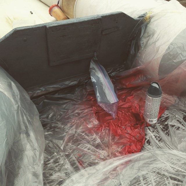
We had intended to spend the day on Portland and either head home late in the day Saturday or perhaps see if the weather window would stretch to Sunday. But Sunday’s forecast never improved and it started to look like the winds Saturday afternoon were swinging south and were going to be higher than predicted. Since I wasn’t sure about the sea legs of our guests and really didn’t want to have to fight the winds all the way, we decided to catch the last of the morning ebb tide and head back to Victoria. Before we cast off, I took the leftover red spray paint from marking our anchor rode ashore and sprayed the 5 metal stern-tie rings that are permanently embedded in the rocks. Hopefully that will make finding them easier for others.
 Once again all hands on deck made casting off a breeze and my dad motored us out of the cove and around the east end of Portland, while Leslie and I joined my mom on the foredeck to enjoy the sunshine and views. But as soon as we turned south the wind came up and it got a bit too cold for sunbathing so we carefully made our way back down the side decks and cosy’d up under the enclosure.
I decided to grab a shower since the engine was running and left Leslie and my dad to navigate us among the islands and rocks off Sidney. At one point the current was so strong we hit 9 knots over ground. After that we figured it was just a few hours of motoring south. But unfortunately the forecast was wrong and the winds picked up to 15 knots or so almost immediately and, of course, were right on the nose. The wind over current meant the waves were pretty short and steep and it turned out to be a bouncy few hours with some spectacular spray over the bow. But everyone seemed to have the right constitutions for sailing and it turned out it was a fairly enjoyable passage despite the bumpiness.
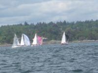 As we approached Baynes Channel and Cardboro Point we noticed about 10 or 15 sailboats headed towards us with spinnakers flying. It seems we were about to motor straight into a regatta or race out of Cadboro Bay. It looked like they were using the V29 lateral buoy off Johnstone reef as their turn point and sure enough, just as we passed it, three boats doused their spinnakers and came racing around the marker pretty much on a collision course with us. I really had no idea what the etiquette was in these situations other than the knowledge they had the right of way — and that I didn’t want to ruin anyone’s race. So I went hard to starboard and pointed at the stern of the last of three boats and watched them cross my bow meters away. Then we turned back onto our original course and dodged the oncoming boats that hadn’t made the turn yet. One of the original three decided to short tack and they came screaming back across our stern, the sides covered in rail meat (crewmembers whose job is primarily to be portable ballast). They tacked back and forth generally on our course off our stern and as they turned into Baynes channel they weren’t that far behind us. Just goes to show sailing in good wind can be faster than motoring. I altered course one more time in Baynes Channel to allow the other two boats who were again on a collision course to slip through ahead of us.
 The current was against us the rest of the way in and was running about 3 knots in Enterprise Channel so we had a bumpy and slow transit through there. My phone rang just about then and it turned out to be the GVHA informing me that the search and rescue guys had found a huge (40′) floating log in the harbour and decided to tie it up to our spot. This meant we were going to have to tie up on the outside of D dock until someone could arrange to move it — not likely until Monday. So an hour and bit of motoring later we turned past Ogden Point and entered Victoria’s Inner Harbour. I did a slow circle around to show off the sights from the water. Then we nestled in between two big boats on the outside of the Wharf Street and tied up. It’s really exposed out there and the winds were up so it was a bit of a rough night; but everyone survived and it was another “great” introduction to the cruising lifestyle.
Visiting Victoria
Sunday morning we spent relaxing, then visited Capital Iron for some last minute fishing gear and then in the afternoon, we hit the RBCM (the museum) for some edumatcation and an IMAX film; we have season’s passes to both so it was a cheap date. A nice sushi dinner finished off the night and then there was some more closely fought cribbage.
 Monday we were up and ready to go early, since we were going to try and do some fishing off Constance Bank. I don’t have a downrigger but we hoped that the gear my dad had brought with him would be enough to get some action going. Rumour has it that the springs are right on the bottom this time of year, so it was not going to be a sure thing. We motored out of the harbour and then spent four or five hours bouncing around outside generally enjoying the sun and the company. The HMCS Calgary joined us for a while doing manoeuvres, and at one point we saw them do a high speed turn in which I am sure they had 20° of heel. It’s one thing to do that in a sailboat but in a 5000 tonne, 450 foot warship it must be something else. We didn’t get any bites, despite having bought the the flashiest flasher you ever saw, but it was a great day to spend the day.
On the way in we stopped to fuel up and I hailed the GVHA on 66A to make sure they had cleared the log from our spot. They had, so we tied up in our regular berth and went through the steps to set the boat up for land-life again, including getting our highspeed internet back. I am really going to miss that when we cast off in the next week or so.
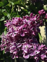 In the afternoon we toured the grounds of St Annes school, popped into the duck pond at Beacon Hill and slid by the Spinnaker’s beer store in James Bay. It was a bit too long of a walk for everyone involved (except Leslie the spring chicken) and we started taking rest stops as we made our way back to the boat. But where better to sit and watch the world go by than in Victoria in the spring. There were roses and lilacs and peonies blooming and it still isn’t even May.
Dinner was on mom so the rest of us relaxed while she prepped some stuffed chicken breasts for our last big meal together. Monday night ended with a few more crib hands, solidly consolidating the lead for one particular team and then we tucked in for the last night aboard.
In conclusion
On Tuesday my parents grabbed a cab at the Harbour Air terminal for their trip back to the airport and we went back to the boat to spend an hour or two trying to put her back into shape for the two of us. But since we are planning on leaving Victoria for good in a week, we ended up with a more hybrid configuration than normal because we will be making her cruise ready soon enough. And that was pretty much it for our guest adventure.
 While I was surprised at how much we had to rearrange to accommodate guests, I was even more surprised at the fact that two extra bodies didn’t make the boat seem crowded. It helped the weather was mostly good and we spent a lot more time out in the cockpit than we had during the winter. Morning coffee out there was especially pleasant as it allowed people to wake up at their own pace and gave every one some space. But overall the fact that everyone was cheerful and cooperative went a long way to maximizing the personal and social space aboard. It would depend on the guests, but I think 4 people wouldn’t be uncomfortable for a couple of weeks or, if everyone was of the right mindset, even longer.
And despite being inexperienced, it was still amazingly helpful having an extra set of hands to take the wheel or keep a watch. And stern tying is 200% easier with a couple of extra bodies. Still, Never for Ever is not just our boat, she’s our home, and it’s nice to have her back the way we are used to.
—Captain Why #Liveaboard, #Posts
Instagram This Week


Do You Know Where You Are Going To?
 I like maps. I also like knowing where I am. I’ve been lost only two times in my memory, and by lost I mean disoriented, having no idea which direction is which or where I was in relationship to the known surroundings. Once was exiting the Metro in Paris amidst tall buildings and not being able to orient myself for about 5 minutes and the other time was sailing in the fog off Tofino as the wind kept shifting. I had the chart plotter zoomed in and was following the wind so when it came time to tack I turned the wrong way and actually gybed. I am still a bit freaked out by that.
So how do I normally keep track of where I am out on the water? Well, besides the trusty old Mark I eyeball, Never for Ever has a selection of tools aboard to help keep us going in the right direction.
Charts
First and foremost we have charts. As I said, I like maps and I would likely have the charts even if it wasn’t a legal requirement (it no longer is in the U.S.). Charts in Canada are issued by the Canadian Hydrographic Service and conform to their standards. They are also available electronically, but more on that later. Canadian charts are a standard size and come in a variety of scales from large scale overviews to small scale details of bays or inlets. And the price is pretty standard too: $20 a chart.

I specify Canadian charts, because the NOAA (National Oceanic and Atmospheric Administration) who are responsible for the American charts provide their data for free and let private companies provide printed charts. Thus you can download the NOAA’s U.S charts in a number of formats including pdfs and ENC files and load them into your devices or print them on your own.
 The most important chart — and often the most undervalued — is Chart 1 : Symbols, Abbreviations and Terms. Not actually a chart, this is a key to all the symbols and terms used in the other charts…because it’s helpful to know if that rock that is shown on the paper chart is awash or under 20′ of water. Sadly we don’t spend enough time with this comprehensive booklet and often are just guessing about what some of the symbols specifically mean.
Our cruising ground is from Victoria to Port MacNeill so I went ahead on purchased the charts I thought I would need; all in all it was almost $1000. I managed to use about 80% of them last summer. Here is the list of Canadian charts we currently carry.
| 3606 | Strait Juan de Fuca | 1:110,000 |
| 3461 | Victoria | 1:80,000 |
| 3462 | Sidney & San Juans | 1:80,000 |
| 3463 | Gulf Is & Vancouver | 1:80,000 |
| 3512 | Sechelt | 1:80,000 |
| 3513 | Comox/Denman/Hornby | 1:80,000 |
| 3514 | Jervis | 1:50,000 |
| 3515 | Kinght Inlet | 1:80,000 |
| 3538 | Desolation Sutil | 1:40,000 |
| 3540 | Campbell River | 1:10,000 |
| 3539 | Discovery Passage | 1:40,000 |
| 3541 | Toba Inlet | 1:40,000 |
| 3542 | Bute Inlet | 1:40,000 |
| 3543 | Cordero Channel; | 1:80,000 |
| 3544 | Johnston Race | 1:40,000 |
| 3545 | Johnstone Neville | 1:40,000 |
| 3546 | Broughton Strait | 1:40,000 |
| 3547 | Queen Charlotte east | 1:40,000 |
| 3548 | Queen Charlotte central | 1:40,000 |
| 3549 | Queen Charlotte west | 1:40,000 |
| 3550 | Approaches Seymour | 1:40,000 |
| 3552 | Seymour inlet | 1:50,000 |
| 3564 | Neville | 1:20,000 |
| 3441 | Haro Strait | Book |
| 3313 | Gulf Islands | Book |
| 3311 | Sunshine Coast | Kit |
| 3312 | Jervis Inlet | Book |
I did pick up a nice overview of the San Juan Islands (in the U.S.) as well. And the last 4 are actually chart books with multiple charts and scales to cover their specified region. This saves us a lot of money (only $80 each) and space.
Last summer we turned off all the electronics for a day and navigated purely by chart. It was a great exercise and something I should probably do more often. Relying on our electronics is a bad habit to get into.
Dedicated Chartplotter
Never for Ever has an older Raymarine E80 chartplotter. This is a device with a screen that displays electronic charts and is hooked up to a dedicated GPS unit so it shows the boat’s position and heading.

Technically I think these units are actually MFDs (multi-function devices). In addition to showing our position, it displays our COG (course over ground) and SOG (speed over ground — as opposed to the speed through the water which is what the knotmeter displays). It also displays the data from the radar. We can plot out out course in advance using a system of way points and it can chart our progress and warn us when we are deviating from our course. It also plots and stores the actually tracks and associated info like speeds and times. All in all a handy device and there are still a bunch of functions I have yet to explore.
The chartplotter came with Raymarine’s Platinum Charts for the PNW which has all sorts of other information like aerial views of certain places, 3D underwater topography and information about ports and features. But the standard charts are the workhorse and honestly the extra features are not something I use a lot.
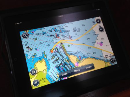
While they are great devices, they’re not infallible. For example while heading to Tsehum last month, the electronic charts on our chartplotter showed an island in the middle of John Passage off Coal Island that did not exist. One should ALWAYS cross reference the chartplotter with what your eyes see and even better, what your paper charts tell you.

The tiny island beside the boat doesn’t exist; which can be a bit freaky if you get used to relying on the electronic charts.
VHS with AIS
Our Standard Horizon Matrix GX2100 is a VHF radio that also has a AIS receiver (see here for more) which receives signals for boats equipped with AIS transponders and displays them on the chartplotter. This allows us to see the speed and course of big ships when we are out near the shipping lanes and, if we were out at sea, set up alarms to warn us of impending collisions.
Apps
 As a back up to the eyeballs, the charts and the chartplotter I also have a collection of apps for my devices. I have the Navionics US & Canada, iNavX, Active Captain, as well as a number of other “free” navigation apps. I say “free” because while the U.S. provides elecrtronic charts for free, as we know Canada does not. So you end up paying for access to Canadian charts regardless.
I was lucky enough to buy the Navionics US & Canada for my iPhone for $5 many versions ago and so it still is capable of running on my original iPad in the 2X view. They have since changed the software to included a standalone iPad version but they charge around $50 for it. It makes sense; the iPhone version is of limited functionality but on the big screen of the iPad it is often better than my dedicated chartplotter. I have downloaded the charts from Alaska to Mexico and it makes a good planning tool for below decks. And the newer version on the iPhone has an autorouting function that allows you to select start and end points and then plots a route for you. While it isn’t something I am prepared to trust, it does give you a quick overview of distances and travel time.
While the graphics at 2X are less than excellent, the 9 inch screen makes using the app a breeze.
I also use Navionics to track our voyages and can email the Google-map compatible kml files to myself to then display on my websites for trip reports. I simply leave the iPad plugged into the 12v (the GPS is a huge battery suck and is only good for about 3 or 4 hours if I don’t plug it in) and hit start. That way I have the iPhone version available to double-check the chartplotter and to use for tides and currents (see below)— and of course, to take pictures with.
INavX gets rave reviews from some quarters and it’s ability to tie into your vessel’s instruments makes it a great choice as a chartplotter replacement. But at a $50 base price with more for the Canadian charts I just couldn’t see it as my go-to app.
Active Captain is a community-sourced cruising guide that has information on ports, anchorages and more. Sadly it has a bigger community on the east coast but it is getting better as more people contribute here in the PNW
Tides and Currents
S unsail rates their charter areas on a scale of 0 to 3. 0 are beginner places like BVI’s with its line of site navigation and predictable winds. The PNW is rated as a 3 — the most difficult — mostly because of our tides and currents. There are several places around the Gulf Islands where the currents can get up to 7 or 8 knots or higher and tides often vary as much as 10 feet. If you don’t know how to predict and plan for these variances you will quickly find yourself in trouble.
The official guide is the Canadian Tides and Current Tables. These are issued new every year and show the predicted tides and currents bay date and time. The most common guide I believe is Ports & Passes. It includes U.S. and Canada and accounts for daylight Savings Time, something the official publication does not and is generally more comprehensive. Also an annual publication it retails for around $20 CDN—well worth the investment.
As I mentioned the tides are also displayed on the Navionics app, which is handy when quickly calculating rodes at an anchorage. But again, it is always best to double-check with the official guides.
Cruising Guides
The last tool in our where-are-we kit is a small collection of cruising guides. The main one is The Waggoner Cruising Guide ($24.95). This is again an annual publication, put out by the same people who produce Ports & Passes. It covers from Puget Sound to Alaska and includes the outside of Vancouver Island and Haida Gwaii. It’s not necessary to buy one every year. I have had mine since 2013 although will likely replace it this year. And it is available every year for free as a pdf. Waggoner’s includes great information on ports and marina’s and is a great planning guide with details about things like transits through rapids and some of the straits and narrows. It doesn’t focus on anchorages but has plenty of information to get you started.
We also have a few of the Dreamspeaker books. We went on a flotilla to the Broughtons with authors Anne and Laurence Yeadon-Jones and picked up a few. They retail for around $50 though so collecting all six (seven with the independently published Puget Sound volume) is going to be a long term project. I find them helpful because they offer suggestions for anchoring locations and have hand drawn illustrations which makes coming into a strange bay or harbour much less nerve-wracking.

There are plenty of other guides available as well and some great books too, like the one we discovered late in the season last year: Best Anchorages of the Inside Passage: British Columbia’s South Coast From the Gulf Island to Beyond Cape Caution, 2nd Ed. Really helpful.
And so…
For me, if I do my homework and pay attention, I am in very little danger of getting lost or running into something I shouldn’t. But there is an old saying, “It’s not if you run aground, it’s when you run aground…” But the more tools I use, the less likely that is going to happen any time soon.
—Captain Why #Equipment, #Posts
Instagram This Week
Instagram This Week


Welcome Aboard!
So, you’ve been invited to go sailing or boating with friends. If you’ve never been on a boat before, you need lots of advice — pronto!
On the other hand, if you’re an owner planning to invite non-boating friends aboard, whether for a short tour of local waters or for an overnight excursion, sharing a few tips in advance will ensure that everyone enjoys the experience.
Based on our experiences inviting people aboard and our travels on other people’s boats, here’s a primer for non-boaters taking a voyage on a sailboat or powerboat.

What to Pack
If you have luggage, bring it in a soft-sided bag, such as a sport bag or a backpack. (Bonus points if it’s scrunchable and can be made small!) Space on boats is restricted, so don’t bring unnecessary items, and power is generally limited so curling irons and hair dryers should just stay home. Be sure to bring polarized sunglasses, your camera (plus wrist strap), and your charging cable (if you’re going to be gone for more than 24 hours).
What to Wear
If your image of sailing involves women in bikinis sunbathing on the prow of a sailboat, you’ve never sailed in the Pacific Northwest. The feels-like temperature on a boat is several degrees cooler than the air temperature due to the wind. Your best preparation is layers, including something with long sleeves and a pair of full-length pants. Even if you don’t wear it, bring a jacket especially one that’s waterproof. Bring a hat and wear sunglasses — the effects of sun are amplified by reflections on the water. It is possible to get both a chill and a sunburn at the same time! Also remember you will likely get wet at some point, whether from spray over the dodger or from wading ashore when you beach the dinghy. And it’s salt water, not fresh, so choose your clothes appropriately.
If you feel cold, speak up. Nothing spoils a trip like hypothermia. Your hosts will likely have spare gloves, hats, and other warm gear.
Wear comfortable shoes with white or light-coloured soles. Basic running shoes are great. Don’t wear heels. Don’t wear new shoes that may cause blisters or shoes that might slip off your feet unexpectedly. No hiking boots, work boots, or other cumbersome footwear, please.
Life Jackets
Canadian law requires your hosts to have a life jacket or other PFD (personal flotation device) for every person aboard the vessel. Whether you wear it or not isn’t entirely your choice, however. Some boaters will insist you wear a PFD; others won’t, but will likely encourage you to do so. Respect your hosts’ directions. Remember, it’s your life they’re trying to protect.

Safety Brief
Our friend Tim, a very experienced boater, always gives a friendly but thorough briefing before his boat leaves the dock. As a guest, you should know where the fire extinguisher is, where the first aid kit is, and where the emergency equipment (such as flares) is. If your hosts forget to show you, don’t hesitate to ask. Your hosts may also show you how to make a mayday call on the VHF radio. (Don’t use the radio otherwise: by law, you need an operator’s certificate to use marine radio.)
Your hosts may also go through a quick man overboard drill with you. No one likes to think about someone going overboard, but it’s always a risk. Pay attention to the drill and know where the equipment is. Yes, it’s rare for someone to fall in the water, but preparation can make the difference if it should happen.
Lending a Hand
If you’re going out with experienced boaters, they’re capable of operating their boat on their own, so your assistance isn’t required although your help is welcome. If you want to help, though, ask before you get involved. Changing a crew’s routines unexpectedly can cause problems.
Once the boat is underway, if you want to help with trimming the sails or taking the wheel, just ask. It’s almost never a problem for someone else to take the helm, and extra hands are always welcome on a sailboat. If you’re not sure what to do, please ask; your hosts won’t know what you don’t know if you don’t ask. But remember, sitting back and enjoying being a passenger is perfectly acceptable too.

On the boat deck, there’s one important rule: one hand for the boat and one hand for the task. If you walk forward from the helm, keep a hand on the life lines or the grab bars as you go. It’s just good safety.
Boats have lots of moving rigging. Whether it’s the anchor chain or the various lines and sheets on a sailboat, moving parts can quickly and easily turn an enjoyable cruise into an emergency. Know how to use the winch or windlass safely before you lend a hand, and make sure everyone else around you knows what you are going to do.
Getting away from and returning to the dock can be stressful moments. If your hosts ask you to hold a line or step off the boat, be sure you understand what they’ve asked you to do and that you’re prepared to do it. Don’t try to be heroic: you put yourself and others at risk. On a boat nothing can be fixed by suddenly doing something unexpected. Stay calm and follow instructions. If someone on the dock offers to take a line, hand it over only when the skipper says to do so. Onlookers are often eager to help but don’t always know what the person operating the boat needs. The person at the helm ALWAYS gets to direct.

Going Below
When you go inside the cabin (“below” on a sailboat), you’ll notice that powerboats are fairly roomy and open while sailboats are long and narrow. If you’re going to be aboard for more than a few hours, you need to learn the subtle steps of the “boat dance,” which involves moving in rhythm with others and anticipating when to shift out of the way. Don’t worry, your hosts aren’t judging, and they will move around you when necessary. But you’ll likely find you’re more comfortable if you pay attention to how other people are moving below deck.

When you are sailing, things will often be stowed in such a way so that they don’t move around as the boat heels (notice the angle of the dish rag hanging over the sink)
While underway, you’re likely to be on deck most of the time. When you go below, avoid opening cabinets or drawers while the boat is underway. If there’s something you need, ask your hosts. After you use something, put it back where it came from. Boaters take the idea “ship shape” seriously. And remember that you’re in someone’s home. Resist your snoopy urges.
The Marine Head
Your hosts will likely show you how to operate the toilet, commonly referred to as “the head.” Now is not the time to be shy or squeamish. Marine heads can be touchy, and fixing the head is — as you can imagine — not a pleasant task, so please follow your hosts’ instructions.
DO NOT flush Kleenex, women’s products, or anything non-organic; Even using too much toilet paper can cause a problem. A common boating truism is “Nothing should go in the toilet that you didn’t eat or drink.” Your hosts will be grateful if you follow this advice. Don’t be surprised if your hosts ask you not to flush toilet paper and instead show you a bag or garbage bin. You might find this unusual or gross, but your hosts know their boat, so follow their wishes. Another truism is “If you break it, you fix it.”
Remember that boats are small and the head is a shared space; be courteous in your usage and respectful of other people’s privacy,
Life Aboard
If the trip is planned for longer than half a day, you’ll learn that a big part of boating involves conservation. Both fresh water and electricity are finite resources, so don’t waste them.
Stay hydrated—fill a water bottle at the beginning of the trip and refill it as necessary. Often the boat’s water tanks will be restricted to cooking and washing; drinking water will be carried in separate containers.
Managing water is easy. Don’t let taps run when you’re not using them. If you shower, turn off the water while you lather up, and go easy on the soap and shampoo to make rinsing quicker. Hot water is also at a premium. To heat water you generally need to run the engine or be plugged in to shore power. If you are at anchor for a day or two you will have neither of these things. The hot water generally stays hot for 10 to 12 hours. After that water needs to be heated on the stove.
Same goes for electricity. Avoid opening the fridge unnecessarily: it draws a lot of power. Turn on lights only when you need them, and turn them off when you don’t. Be sure your hosts can spare the power to charge your electronics before you plug them in (most mobile phones are OK, but laptops may require an inverter). Any small appliances are usually not able to be used if you are not plugged into shore power.
Many boaters try to follow the light — early to rise and early to bed. If you’re a night owl, you might want to tuck a flashlight or headlight in your luggage rather than drain the ship’s batteries staying up all night.
Most boats in the PNW will have heaters but they don’t run them constantly. Be prepared that you might wake up to a chilly boat in the morning before the air warms up.

Beer and Boating Don’t Mix
While the boat is underway, there’s no need for alcohol. Raise a glass only when you reach your destination. Remember too that between the sun and wind it’s easy to get dehydrated. Drink lots of water during the day so that first cold beer doesn’t hit you too hard.
Seasickness
Non-boaters often worry about feeling seasick and being embarrassed. Depending on the water and weather, you may in fact start to feel ill. It happens to everyone at some point — don’t be ashamed! The combined noise of the wind, the waves, and the sails (if you’re sailing) or the engine (if you’re motoring) can be overwhelming, too, even if you don’t feel nauseated.
To combat seasickness, stay on deck. Look at the horizon, not at the water. Don’t go below — the effects of motion can be worse inside the cabin. Eat a light meal before you go out — lots of carbs, limited fats, no alcohol. While you’re underway, take small sips of water to stay hydrated and keep your GI system calm. Ask to take the helm; doing a task is often the best preventive for seasickness.
If you’re below deck and think you’ll be sick, use the head, not a sink. If you’re on deck when you feel ill, stick to the leeward side — the side that’s facing away from the wind. (The expression Don’t spit into the wind applies here.)
Home Again, Home Again
When the vessel comes back to its home dock, remember that docking a boat isn’t quite as simple as parking a car. It will take your hosts a while to tie up, connect to power (if applicable), and otherwise secure the boat. Be patient. Your hosts need to work through various steps, sometimes in a specific order, to ensure the safety of their vessel. You’ll be the centre of their attention again in a few minutes.
We love our boat, and we love having guests aboard so we can share our enthusiasm with them. Making our expectations clear at the outset definitely helps a trip go better.
—Herr Doktor #Liveaboard, #Posts
Baking Bread
One of the things I miss most about living aboard is that the freezer (especially on batteries) is not quite up to the job of keeping bread fresh. We make do with preservative-heavy Wonderbread a lot of the time and try and plan things like hotdogs and hamburgers around shopping trips.
But one of our missing crew is a fabulous cook and she had a recipe for a no-knead bread that she would treat us with, so I decided to get her to send it to me after we hit Victoria. It turns out we needed something like a Le Creuset dutch oven, but that wasn’t in the budget. So we headed down to Capital Iron and picked up an old school cast iron pot with lid that would fit in the boat’s oven. Forty dollars later and a bit of seasoning and we were good to go.
Doing some research here I found that apparently no-knead breads are a big thing and I certainly have grown to embrace them. It takes about 5 minutes to blend flour, yeast salt and water and then you put it aside for 18 hours or so and you have great dough for pizza or bread for dinner the next day. These days I usually make a batch or two every week. This recipe was also featured on page 21 of the March issue of T8N Magazine.

C’s Boule

- 3 cups flour
- 1/4 tsp instant yeast
- 1 1/2 tsp salt
- 1 1/2 cups water (room temp or cold)
Put the flour, salt and yeast in a bowl. Add the water. Mix with a wooden spoon until dough is shaggy. No need to knead.
Cover with plastic wrap. Let sit for 12 to 21 hours.
Use as-is for pizza dough.
For a boule, punch down the dough (use flour — it will be sticky), and form it into a ball. Roll the ball in flour, and place it on a large plate. Cover loosely, and let rise until double (1 to 2 hours)
Put a Dutch oven with a lid in the oven, and heat it to 425°F.
Flop the risen dough into the hot Dutch oven, cover and bake in oven for 30 min.
Remove the lid, and bake 15 minutes more.
A few boater caveats
I make a 2/3rds version of this recipe for my smaller cast iron pot. And I usually just put the oven on the highest setting and bake it for a bout 35 minutes before taking the lid off. Then I just monitor it for browning, giving it a thump or two to see if it sounds hollow.
 It makes terrific pizza dough
 Try adding 2 tsp of sugar and cinnamon and a 1/2 cup of raisins
—Captain Why #Liveaboard, #Posts
Instagram This Week
Easter Sail…errr…Cruise
We really hadn’t done much sailing this winter and were still a bit trepidatious about the cold. So we’d been humming and hawing and watching the weather and making no decisions as Easter quickly approached. But our usual office space at the public library was closed Friday, Sunday and Monday and we had no other plans. There was no reason not to go except fear of the cold.
Day the First
So Friday morning I popped my head out the hatch, noticed a couple of boats gone from the docks and said, “Let’s go…” Now apparently, unbeknownst to me, the plan was for us to go, if we were to go, Saturday. But since Friday, Saturday and Monday was forecast to be sunny and Sunday was supposed to be cold and rainy, it made no sense to me not to have at least one nice day to hang out somewhere. Besides those other boats had gone already. And it looked like a few more were prepping. Get the feeling I am easily led? Sometimes… 🙂
Anyway, I checked the freezer and there were at least three days of meals there and tons of backup supplies like pasta and canned stuff. The only critical item was milk for morning tea and we had just enough. So I made a command decision and broke out the checklist and less than 45 minutes later we were rounding Odgen Point and headed for Haro Strait. Somewhere along the process of getting ready we decided on Royal Cove on Portland Island as a destination. We’d spent three or four days there last fall and it was protected and peaceful, and had lots of hiking. My only worry was that being so close to Sidney and Tsehum it might be packed with weekenders. So our fallback would be wandering over to Roche or heading to Tod Inlet or Genoa Bay. It was only 10:45 as we exited Victoria Harbour so we had plenty of time if we needed it.

The forecast 5-10 knots was more like 2-3 so we motored at around 2200 rpm, conserving fuel and enjoying the sunshine. The Nordhavn 40 Aegis (a gorgeous ocean-going trawler that somehow looks less than suited to our cruising area) from B dock pulled out just ahead of us and we followed in its wake — albeit a knot or two slower. Once we passed through Enterprise Channel, we met up with 5 or 6 other boats coming out of Oak Bay and Cadboro Bay and heading east. My suspicions that it was going to be busy were looking correct. But as we all cleared Cadboro point they headed off like stately ducks in a row towards the NE, following after Aegis and presumably off towards San Juan Island.
We motored in the glassy water of Haro Strait past Sidney Spit and enjoyed all the sights and sounds of the busy water off Sidney. I went below to make some no-knead bread dough for the next day while Leslie took care of the helm. A bit later we passed through the many islets and rocks around the north part of Sannich penninsula and entered into Moresby Passage. Right about then I spotted a Beneteau with green canvas ahead and speculated it might be Bula, one of the boats from our dock. Sure enough, as we got closer we confirmed it; they had their sails up and were stubbornly motorsailing their way north. I hailed them on the VHF and it turned out their destination was also Royal Cove. A few minutes later we passed them and then watched the monstrous Coastal Celebration slide by us as we shared the suddenly much narrower passage.
Much to my surprise Royal Cove was empty. We circled around and picked a spot as deep in as we could get on the east side to avoid as much of the ferry swell as possible and dropped anchor. As stern ties go it was one of our better ones and I managed to get the stern in close enough that we could loop the line through the iron ring on shore and back to the boat. That way when we left we could just pull the line without having to row back ashore. Leslie was able to keep the stern pointed basically at the shoreline and only had to do a little maneuvering to give me enough slack to get the line back to the boat. Bula pulled in a few minutes later and tied up a couple of rings down, and we were set for the night. Bula was apparently only here overnight since their girls were keen on the Easter Egg hunt at Poet’s Cove on Pender Island, so we might end up getting the cove to ourselves for most of the weekend.

We stripped back some canvas to let the sun into the cockpit and enjoyed the peace and quiet. You can actually feel the pressure disappear after you turn off the engine and begin to absorb the silence of these islands. Victoria is a great place to be but between the noise, overflying seaplanes and the boat’s constantly running heaters you forget how much pressure a city puts on your senses. The sensation you feel in those first few moments when you are finally settled in at anchor is like that ice cold glass of water on a hot day: just what body and soul needs.

After a while I bestirred myself to make some baked pasta for dinner and then we settled in to watch videos on the laptop before bed. As the sun set it cooled down so we fired up the Webasto for an hour or so before bedtime, added an extra quilt and then snuggled in for the night.
[flexiblemap src=”http://macblaze.ca/kmz/Easternumber1.kml”]
Day the Second
Morning was cold. C-O-L-D! I sprang out of bed, hit the breaker for the heating system, snapped on the Webasto and switched the fans to high; then I dived back under the covers to wait for the boat to heat up. On the way by I glanced at the thermometer and it was reading 8° C (46° F) in the cabin. Brrrrr. But at with the heater at full blast, the cabin doesn’t take long to start warming up. We hadn’t used the diesel heater much since we installed the battery monitor, so I took a few moments to take some readings after I crawled out from under the warm covers. After the initial start-up phase of 6 or 7 minutes, the Webasto seems to draw about 4 or 5 amps. It is a hydronic unit and has 3 radiators with fans: aft cabin, salon and another split between the forward cabin and the front of the salon. The fans draw about another 2 amps each, and it doesn’t seem to make that much difference if they are on high or low. So running the heater draws around 6 or 7 amps, which wasn’t too shabby as long as we were judicious in its use. By 4 pm that day, which was 24 hrs after we arrived, between the fridge, heater and various other lights and such, we’d used about 12% of the battery or 25% of our total available battery power. That gave us 4 days at that rate: not bad.
As the sun came over the trees, I grabbed a blanket and headed out into the cockpit with my book and coffee and settled in to relax. It was a slow day. So slow that we barely left the boat. One short hike out to the point and a slow meander back along the shoreline was the sum total of our physical activity.

Along the way I indulged myself taking pictures of wildflowers and sticking my nose in cracks and crevices along the shore cataloging the sea life. We spotted plenty of the ubiquitous purple starfish and a few smaller orange and white ones. I also spotted a horny orange tube which I dubbed a sea cucumber. Back at the boat I looked it up and I think it was a California Sea Cucumber (Parastichopus californicus), but you tell me…

Back on board we read, I made some dinner rolls for the next day’s lunch and baked the boule (no-knead bread), and then basically we hung around doing very little for the rest of the day. At low tide a small racoon came down to forage and entertain us, and later we watched a kingfisher zoom back and forth hunting dinner.


Leslie couldn’t leave the buns untouched until Sunday so helped herself to an advance copy. Reviews were good. Dinner was pork chops and fresh bread. After a warm, sunny day we left the heater off, played a bit of crib by candlelight and watched Guardians of the Galaxy under a blanket before heading off to bed.
Day the Third
Happy Easter. It seems neither of us had the foresight to buy any chocolate so we had to be satisfied with coffee and tea. The morning was a repeat of Saturday although I think we had acclimatized to the temperature a bit. Sunday was suppose to be rainy but it wasn’t socked in; more of an intermittent thing with moments of sunshine and warmth interspersed with cloud and rain.
We packed a lunch and made some ice tea for our water bottle, then layered up and headed out. Today we were going to loop the whole island and do the one remaining bit of trail we’d never done yet — 6 or 7 kilometres total. Along the way I took a ton of wildflower and mushroom images, but I had only my iPhone so many of the smallest flowers didn’t turn out or were blurry. Spring is an amazing time of year for the amateur botanist; hopefully we will be back at end of April to see the next bunch.

We ran into five or six other parties on the trail, one fellow even doing it in a walking cast and crutches, which is pretty ambitious on some of the rougher parts. They must have all been kayakers, though, as there were only two boats in Princess Bay and one of those had its dinghy still on deck. On the west side of the island a pair of racoons were fishing on the rocks as we walked off-trail along the shoreline, and they seemed pretty put out that they had to wander back to the forest to let us pass. We ate fresh bread and jam for lunch in the sunshine on the midden beach facing Brackman Island and enjoyed the quiet and the view. We had to strip off most of our layers since it was so warm in the sun. But the rain came back about 20 minutes later and we bundled up again and head toward Kanaka Bluffs on the last half of our hike.

The intermittent rain and sunshine produced some lovely visuals with mist rolling off moss-covered boulders and the verdant green forest constantly playing with lights and shadows. Most of it is impossible to capture with a camera but it’s always well worth pausing and taking in the moments that hikes like this present. Even if you are standing around in the rain.

Five hours or so later we arrived back at the boat and stripped off our muddy clothes in exchange for something warm and dry. Then it was back to relaxing until dinner started calling. I fixed up some crispy-skinned, bone-in chicken thighs — one of my all time favourite meals (thanks, C) — and roasted honey-dijon and garlic potatoes.
That night’s video fare was an episode or two of the acclaimed series It’s Always Sunny in Philadelphia. It’s another of those comedy where none of the characters seem to have any redeeming characteristics (we are still reeling bit for watching the British version of The Office). The jury is still out whether it’s going to be part of the rotation or not.
Day the Fourth
Well, it seems we are all hardened up and the heater was barely on at all the next morning. Part of the reason for this trip was to see whether we are ready to leave Victoria for good, and I have to say, if we can count on this amount of sunshine, then I am pretty certain it won’t be much hardship when we decide to go.
The tide was going out and it looked like if we left right away we would catch the current and hit Discovery Island right at peak flow (in the right direction) so we washed up a bit and prepped to go. A lovely boat named Luna Quest had pulled in early the previous evening and the hardy souls aboard (all young men) had braved the frigid water for a quick dip accompanied by some loud expletives. This morning they too were prepping to go so we let them cast off first before we let slip the stern line.
Our departure wasn’t without a bit of drama as the wind swung our stern out towards the dinghy dock ( which I had anticipated) and then we popped the windlass breaker (which I had not) and Leslie had to dive below to reset it. At this point, for some stupid reason, I hit the auto pilot and was bringing in the stern line. The stern cleared the dock with ease but was now drifting towards the shallow water and rocky shore and we were —I thought — over our anchor chain. When I grabbed the wheel to move us off it wouldn’t budge. I yelled forward that maybe the chain was interfering with the rudder, but after the panic-adrenaline cleared, I suddenly remembered that the auto pilot was on. Cursing, I flipped it off, maneuvered the boat to the centre of the cove and willed my heart rate down back to something approaching normal. It’s not the first time I have forgotten about turning on the auto pilot, and I think I am developing a potential dangerous habit.
Exiting the cove, we swung west to follow the curve of Portland Island and headed for home. The winds were around 12-15 knots as we entered the channel so we had high hopes we would be doing some sailing after we cleared the busy waters. The fuel gauge was currently reading below a 1/4 of a tank. We had last filled in Roche Harbour last October, but math said we should have a little over half a tank left. But that was not counting whatever fuel the using the diesel heater during the winter had used, although that was supposed to be minimal. Redoing the math we decided we were good for the 4 or 5 hours we needed to get back to Victoria. But as we approached the islands off Tsehum Harbour I started second-guessing myself and eventually declared a state of “better safe than sorry” and turned in towards Swartz Bay and the Van Isle fuel dock.

I played a bit of chicken with the ferry as we approached the pinch point between the buoy off Knapp Island and Coal Island, but he had plenty of room after I scooted across the channel. Then we turned down John Passage. The only other time I had been down this narrow zigzagged passage was on Tim’s Baltic 42 the day we had decided to do a whole trip with the chart plotter off. So it was a bit of a surprise that my Navionics Platinum charts showed an island in the middle of the channel. Visually I could see nothing and the paper charts said there was nothing. I even checked the Navionics app on my phone and it said there was nothing. But it is still a bit disconcerting to drive your boat through a land mass on the chart plotter. So, for my subconscious’ sake, I ended up skirting the edge of the invisible island. I was still in better-safe-than-sorry mode.

We fuelled up in Tsehum and put in $45 of diesel (14 gallons) — just a bit under half a tank. So I guess our math was right and our gauge was wrong. Good to know it errs on the side of caution, though. Then we motored back out into Haro Strait and headed south in 5 knots of wind directly on our stern. We just didn’t bother with the sails. Instead I headed below for a much n-eded shower since the engine had been busily heating water for the last hour or so.

Two hours later, as we approached Cadbury Point, I scanned the horizon and lo and behold the sailboat off our port bow was Bula, also making her way home. She had her sails up and we decided that, after we darted up Mayor Channel off Trial Island, we would raise our sails and sail home even if the winds were light. Get the feeling we don’t like sailing in narrow channels? That’s just another “bad” habit we need to break. But this turned out to be a bad plan. The winds and currents around Trial Island are confused to say the least and every time we turned the engine off we ended up restarting it to move us further off the island. For awhile there we were actual sailing sideways. Eventually, as we turned into the Strait of Juan de Fuca proper, the winds shifted almost 180° and we were still going nowhere. Bula seemed to be doing okay, but I later confirmed they were motor sailing most of the way until they cleared the currents and channels. Eventually we gave up and motored home. Bula stuck to their guns, though, and headed off into the Strait on a port tack. They arrived back on the dock only about an hour and a half after us so I am guessing they are way better sailors that we are.

As we rounded Ogden Point we dodged a few seaplanes and pulled out the lines and fender in preparation for docking. About 40 minutes later the boat was back in liveaboard mode, all the tanks were topped up and Leslie was enjoying her first hot shower in a couple of days. We then rewarded ourselves with a visit to our favourite pub (Garrick’s Head) for dinner and a couple of pints.
It had been a great weekend and the first, I hope, of many more in the coming weeks.
[flexiblemap src=”http://macblaze.ca/kmz/Easternumber2.kml”]
—Captain Why #Posts
Instagram This Week


