Instagram This Week

Thoughts on the state of the political world
There was a recent, almost playful, discussion on one of the sailing forums the other day about the potential northward invasion of our American neighbours. It devolved —just a bit — into finger pointing for a while and I chimed in with a few thoughts. But I thought I would (re)record them here for my future self in case I ever get overly frustrated with the universe.
I’m not so left or so right that I think the system — or systems if we are speaking generically of Western world politics — is in any danger; they’ve been designed to weather the storms of a redneck America or a socialist Alberta. It’s the ignorance and inherent laziness of people that scares me; While I welcome Americans who want to try a lifestyle that includes 40° below (celsius or fahrenheit) as a normal fact-of-life, I truly believe they need to stay the course, educate themselves and fight for their own values. whatever they are.
We all just need to get our heads out of our asses and work: to build consensus, educate ourselves and our neighbours, and put our brains to work, rather than hiding behind simplistic ideas of “right” and “wrong.” A quote out of a recent CBC article encapsulates the sort of dangerous “smug” assumptions voters make:
Despite what many smug Canadians would like to believe, there are those among us who, for example, worry about proper screening at the border, or about integration among new immigrants — there are even those who use the phrase “left-wing elite” non-ironically.
Anyone naive enough to believe we don’t have Trump-like people here in Canada is just as dangerous as someone who thinks a “Canadian Values Test” will keep out any but the most honest of applicants.
I don’t care if you are pro-gun or antigun, a rabid Rocna fan or a Delta devotee, just because you think everyone else is an idiot and should just bugger off doesn’t mean that it’s ever going to happen. And frankly that belief is more destructive than a hundred Trumps.
…
But weren’t we talking about American beer?
Instagram This Week

Instagram This Week

Instagram This Week


Instagram This Week

Instagram This Week
Not So Offshore: the Vancouver to LA Summary
(originally posted on neverforever.ca)
In my last post I mentioned I was heading down the coast in a friend’s Baltic 42. The goal was to take it from Vancouver to San Diego so they could join the Baja Haha at the end of October. We allotted approximately 3 weeks for the journey and I imagined that it would primarily be an offshore trip with two or three legs.
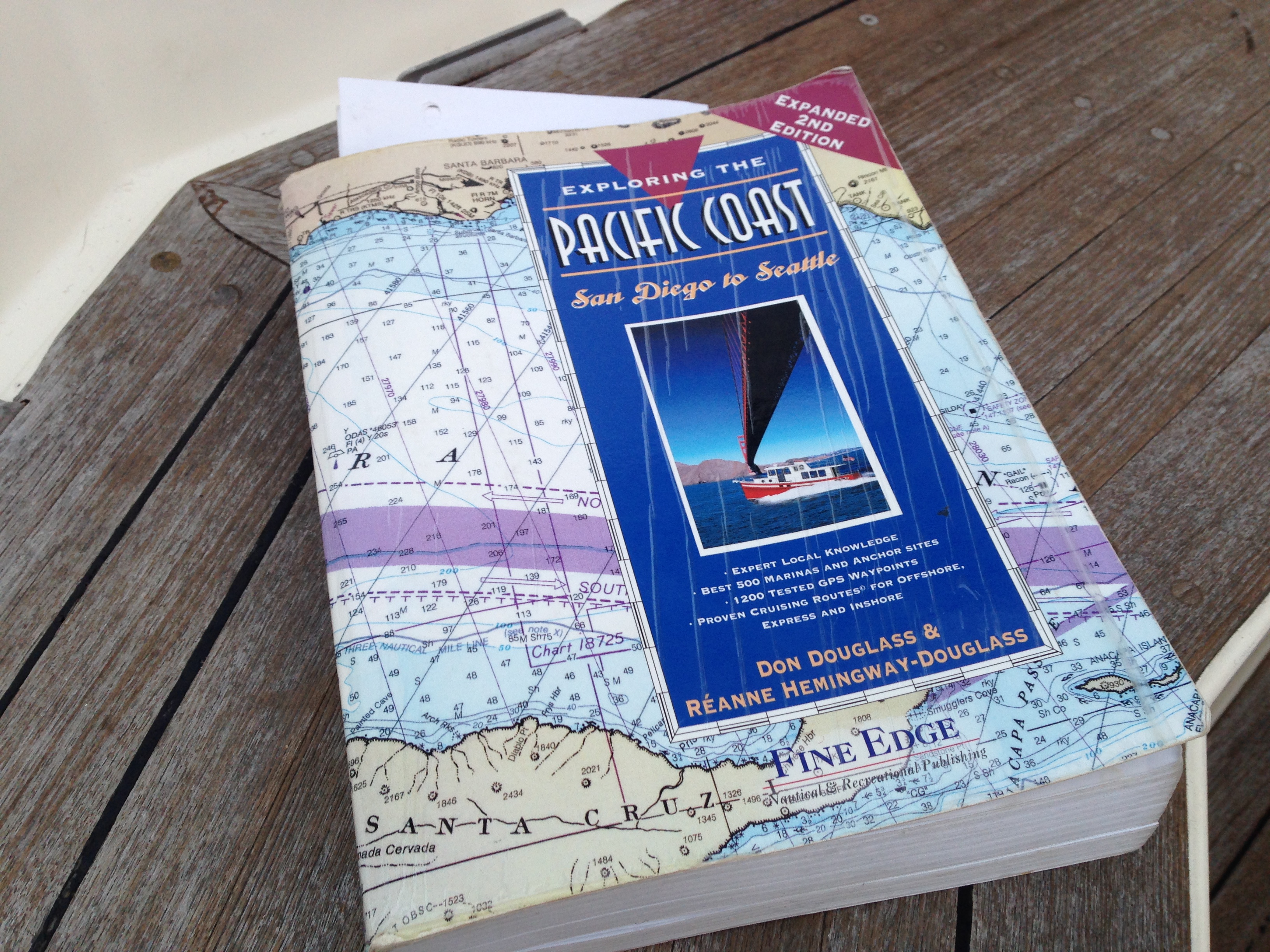 Well it turned out that they —and their buddy boat Sea Esta X — decided to loosely follow the “Express Route” as set out in Exploring the Pacific Coast: San Diego to Seattle by Don Douglass and Réanne Hemingway-Douglass. This meant the voyage would mostly be day trips—albeit some fairly long ones— with only a few overnighters.
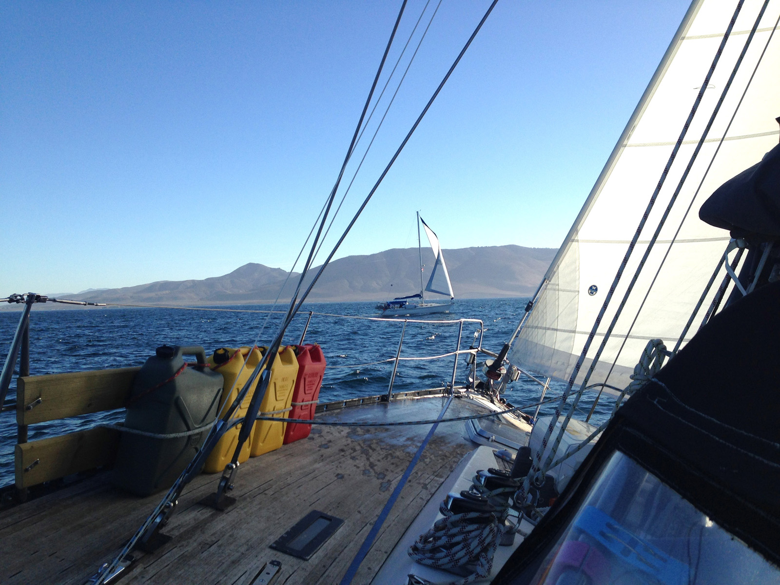
We got some good downwind sailing and a remarkable amount of motoring. That is, in my lowly opinion, the big downside to harbour-hopping down the coast. The nature of the bars at most of the ports is such that entering and exiting them is often tide and weather dependent: so trying to hit a schedule becomes a bit more important and it’s hard to justify much sailing in light winds.
When we hit Marina del Rey in Los Angeles, it really was time to start taking it easy, so rather than rush the last couple of days to San Diego, I decided to take advantage of the proximity to LAX and fly home from there. Northwest Passage continued on without me and, as of today, I think they still haven’t completed the “two day” trip to San Diego. Good on ’em.
 Bars
Bars

Most of the ports on the pacific side of North America are in the mouths of rivers. This generally means you are negotiating breakwaters, dredged channels and bars. Bars are really what can make entering and exiting these ports uncomfortable or even impossible. Bars are formed by the sediments deposited by the rivers outflow and when the incoming swell hits this suddenly shallow area, steep and dangerous waves can occur. Quite often these bars will be closed to small boat traffic and occasionally they will be closed altogether. That means if you arrive at a bar at the wrong time you can’t come in to the harbour and will have to head offshore again to either wait, or move on to the next port in hopes their bar will remain open. The coast guard is constantly going out in these super tough little aluminum boats (47-foot MLBs) to physically check on the conditions and then report them on channel 16.
We were pretty lucky and got into all our ports without incident, although sometimes in the middle of the night, the middle of dense fog, or in one memorable entry, both. There were numerable small boat closures though.
Details?
I blogged about the whole trip in near real time and you can read about it over on macblaze.ca although it intended was more for family and friends and rife with errors and typos. I learned a lot about downwind sailing, saw hundreds of whales, dolphins and sea lions and thoroughly enjoyed myself, with the most memorable moment being alone on deck going around Cape Mendocino at 3 am in 30 knot winds. I’ve also posted a bunch of images at the end of this post.

 The Stats

- Trip length: 29 days
- Travel days: 20 days
- Legs: 16
- Travel hours: 232:25
- Total km: 2392.4
- Total nm: 1291.9
- Hours motoring: 200 hrs
- Fuel used 520 L
- Overnight sails: 3
- Longest leg: 54 hrs
- Ports (marinas): 12
- Anchorages: 4
- Mooring Balls: 1
The Trip
| Day | Kilometers | Nautical Miles | Hours | |
| 1 | Granville Island, Vancouver to Shallow Bay, Sucia Island (via Point Roberts) | 84.4 | 45.576 | 5:00 |
| 2 | Sucia Island to Anacortes, Washington (via Vendovi Island) | 45.7 | 24.678 | 5:20 |
| 3 | Anacortes to Neah Bay | 165 | 89.1 | 15:40 |
| 4 | Neah Bay to La Push (around Cape Flattery) | 76.1 | 41.094 | 7:25 |
| 5 | La Push to Westport Marina, Gray’s Harbor | 130 | 70.2 | 12:25 |
| 6 | Gray’s Harbor to Newport, Oregon (overnight) | 271 | 146.34 | 25.75 |
| 7 | 0 | 0 | 0:00 | |
| 8 | 0 | 0 | 0:00 | |
| 9 | 0 | 0 | 0:00 | |
| 10 | Newport to Charleston Marina, Coos Bay | 151 | 81.54 | 13:45 |
| 11 | 0 | 0 | 0:00 | |
| 12 | 0 | 0 | 0:00 | |
| 13 | Coos Bay to Noyo River Basin Marina, Fort Bragg, California (around Cape Mendocino; via Crescent City) | 498 | 268.92 | 54.00 |
| 14 | 0 | 0 | 0:00 | |
| 15 | 0 | 0 | 0:00 | |
| 16 | Fort Bragg to Bodego Bay | 166 | 89.64 | 16:25 |
| 17 | Bogego Bay to Pillar Point Harbour, Half Moon Bay | 120 | 64.8 | 11:45 |
| 18 | Pillar Point Harbor to Moss Landing | 114 | 61.56 | 10:50 |
| 19 | 0 | 0:00 | ||
| 20 | Moss Landing to Morro Bay | 212 | 114.48 | 20:50 |
| 21 | 0 | 0:00 | ||
| 22 | 0 | 0:00 | ||
| 23 | 0 | 0:00 | ||
| 24 | Morro Bay to Cojo Bay (around Point Conception) | 141 | 76.14 | 11:45 |
| 25 | Cojo Bay to Santa Barbara | 71.6 | 38.664 | 7:10 |
| 26 | Santa Barbara to Ventura | 43.6 | 23.544 | 4:00 |
| 27 | Ventura to Pacific Mariners Yacht Club, Marina del Rey | 103 | 55.62 | 10:20 |
| 28 | 0 | 0:00 | ||
| 29 | 0 | 0:00 |
Google My Maps version
Google My Maps seems to need a Google account to access it, although I can’t prove that. But zoom in if you can and check out some of the harbour entrances and remember most of them were done in the fog or the dark or both.
Some Images


Humpbacks and grey whales abounded.

The first part of the trip was often cold and foggy.

Newport Oregon emerges from the fog

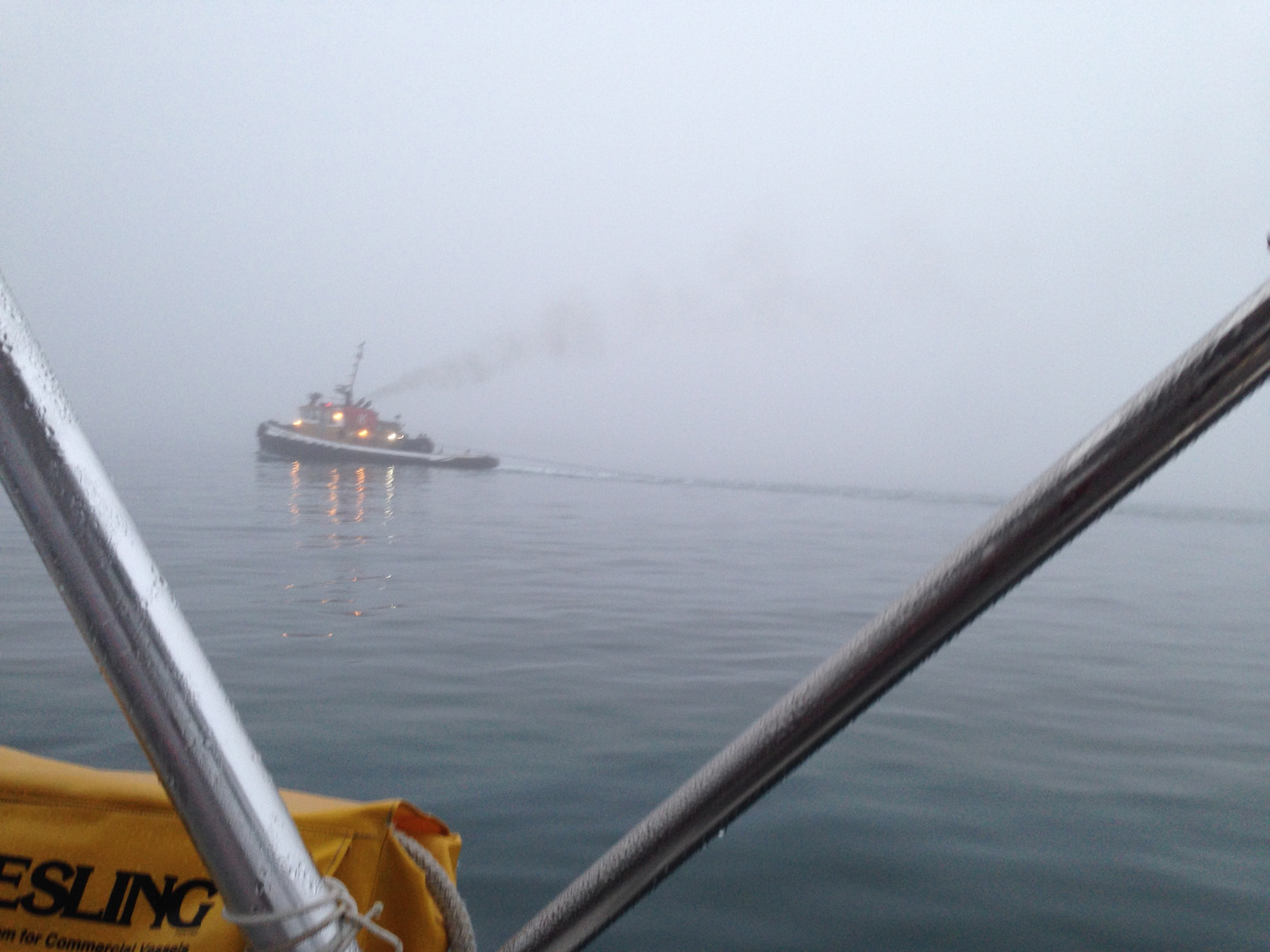
Entering Coos Bay in the fog

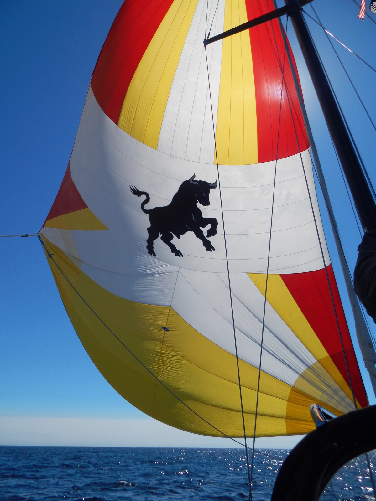
The old spinnaker cut down to a gennaker. It made for some great (and easy) downwind sailing.


Morro rock in Morro Bay.
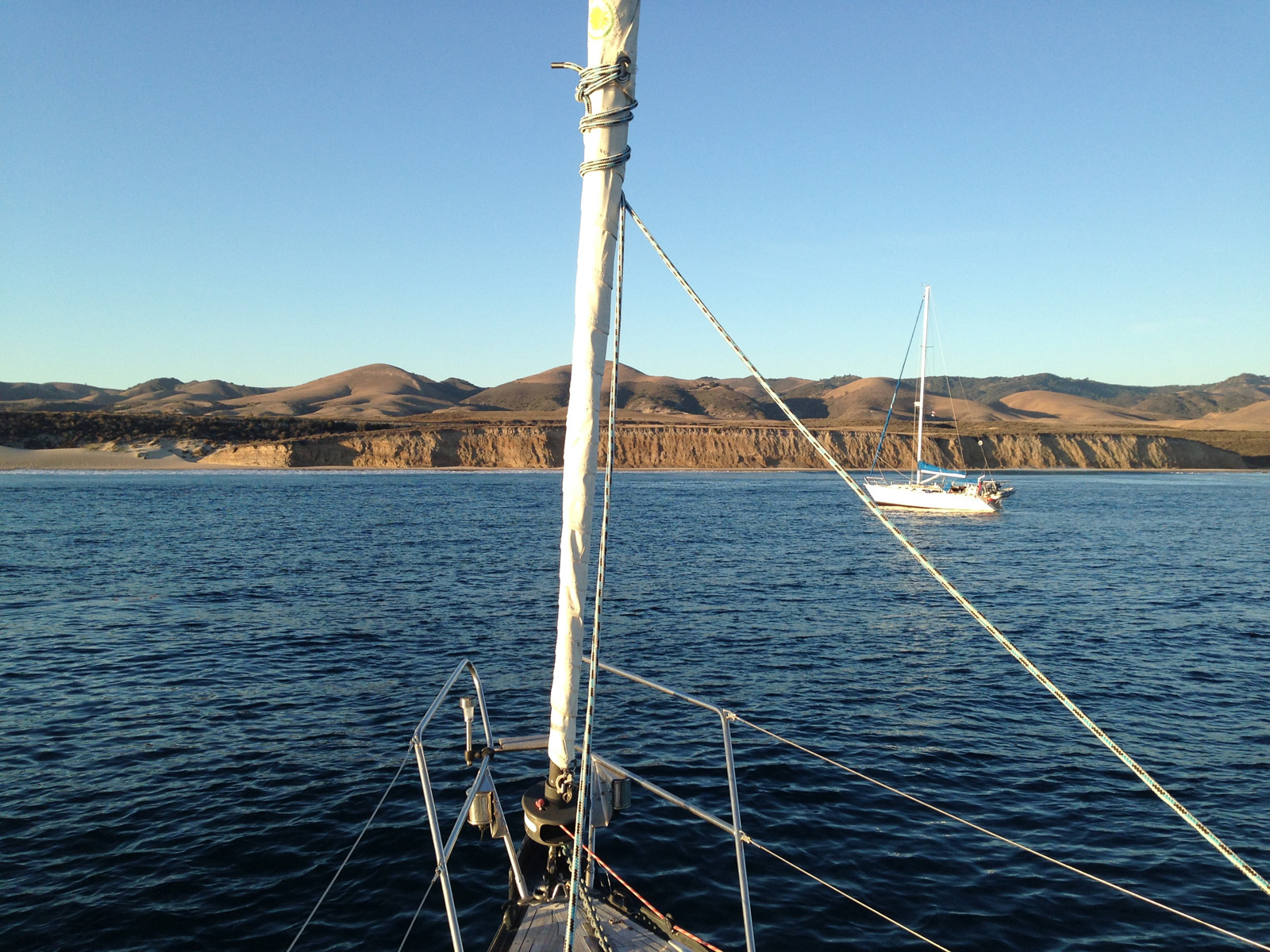
Cojo Bay anchorage

And then suddenly, immediately after rounding Point Conception, it was warm

At anchor in Santa Barbara

Our last sail of the trip

Santa Monica Pier from the ocean side


Malibu from the air
—Captain Why #Posts
Instagram This Week


Vancouver to LA: The Wrap up
Well I have been home for a few days, and sorting through my 1200+ images and movies. Surprisingly there aren’t a lot of “fantastic” shots. I guess the ocean kind of looks the same after a while unless you are actually there. And a lot of the real interesting stuff was impossible to get a shot of. I have gone through and fixed a few things in my blog entries and extracted some data as well as plotted all my waypoints and gathered all my statistics. I will jot them down here for posterity.
Northwest Passage is now in Newport, CA and on their way south to San Diego. I am pretty bummed that I couldn’t do the whole trip but at the same time pretty glad to be home. They will pick up more crew at the end of October in San Diego and then head south with the Baja Hah, before making their way to their final destination of Zihuateneo, Mexico. I am so grateful I got to do this trip. Thanks Tim and Donna!
My Final Take
It wasn’t that hard. I was worried that a long offshore voyage wouldn’t be for me, but in the end, while it was challenging and occasionally intense, it really wasn’t that difficult. Like all things sailing, prudence goes a long way. I think if we had done a lot more overnights then having more crew would have been good, because your energy levels start to diminish over time. But overall it was a fairly pleasant journey with the minimum of nerve-wracking experiences and a lot of glorious ones.
Having a solid boat counts for a lot. Watching Sea Esta X bob and bounce over the swell and comparing it to the real sense of secureness I felt on Northwest Passage, I can certainly begin to see where all the bluewater boat arguments come from. Because on a long downwind sail like that, it is the swell that you affected by much more than the wind.
Would I do it again? Yup.
The Stats
- Trip length: 29 days
- Travel days: 20 days
- Travel hours: 232:25
- Total km: 2392.4
- Total nm: 1291.9
- Hours motoring: 200 hrs
- Fuel used 520 L
- Overnight sails: 3
- Longest leg: 54 hrs
Daily Distances
| Day | Kilometers | Nautical Miles | Hours |
| 1 | 84.4 | 45.576 | 5:00 |
| 2 | 45.7 | 24.678 | 5:20 |
| 3 | 165 | 89.1 | 15:40 |
| 4 | 76.1 | 41.094 | 7:25 |
| 5 | 130 | 70.2 | 12:25 |
| 6 | 271 | 146.34 | 25:45 |
| 7 | cont’d | cont’d | cont’d |
| 8 | 0 | 0 | 0:00 |
| 9 | 0 | 0 | 0:00 |
| 10 | 151 | 81.54 | 13:45 |
| 11 | 0 | 0 | 0:00 |
| 12 | 0 | 0 | 0:00 |
| 13 | 498 | 268.92 | 54:00 |
| 14 | cont’d | cont’d | cont’d |
| 15 | cont’d | cont’d | cont’d |
| 16 | 166 | 89.64 | 16:25 |
| 17 | 120 | 64.8 | 11:45 |
| 18 | 114 | 61.56 | 10:50 |
| 19 | 0 | 0 | 0:00 |
| 20 | 212 | 114.48 | 20:50 |
| 21 | cont’d | cont’d | cont’d |
| 22 | 0 | 0 | 0:00 |
| 23 | 0 | 0 | 0:00 |
| 24 | 141 | 76.14 | 11:45 |
| 25 | 71.6 | 38.664 | 7:10 |
| 26 | 43.6 | 23.544 | 4:00 |
| 27 | 103 | 55.62 | 10:20 |
| 28 | 0 | 0 | 0:00 |
| 29 | 0 | 0 | 0:00 |
| Totals | 2392.4 km | 1291.9 nm | 232:25 hrs |
Embedded map version
This is a map of all the actual waypoints I recorded along the way. I used it to calculate the distances. A lot of times when we were sailing we would be tacking back and forth which may not be represented in the paths or the stats above so the numbers are approximate.
[flexiblemap src=”http://macblaze.ca/kmz/Van-LA.kmz”]
Google My Maps version
Google My Maps seems to need a Google account to access it, although I can’t prove that. That’s why I embedded my KML file above so I won’t be dependant on Google. But zoom in and check out some of the harbour entrances and remember most of them were done in the fog or the dark or both.